Data Loss Areas in the Depth Map
This tool detects the data loss areas in the depth map. Areas with data loss due to various reasons are highlighted in different colors to assist with parameter settings.
A point cloud is generated by converting each pixel in the depth map into 3D spatial coordinates. Therefore, the loss areas in the point cloud typically correspond to the data loss areas in the depth map. If there are areas with data loss in the point cloud output by the camera, this tool can be used to analyze the data loss areas in the depth map and their causes. By adjusting the relevant parameters, the point cloud quality can be improved.
When data loss occurs in the point cloud, follow these steps to check the data loss areas in the depth map:
-
After the camera is connected, click the Depth Map tab in the data display area.
-
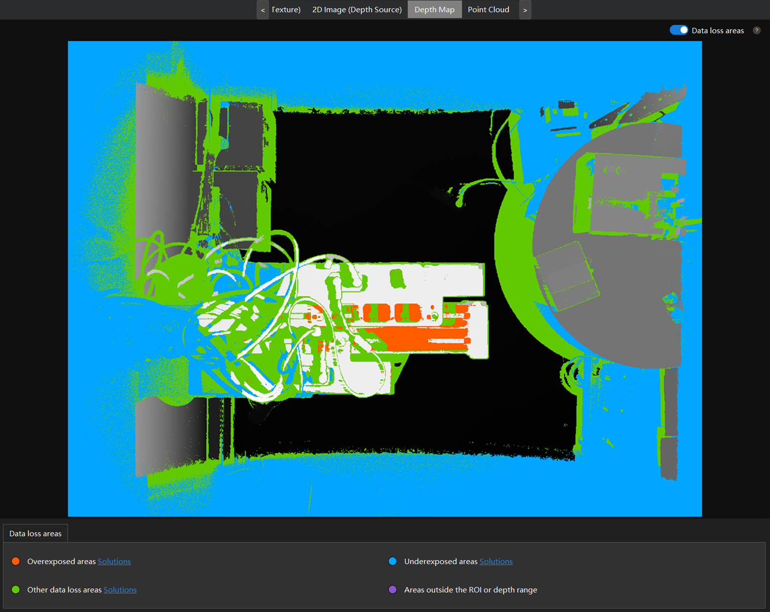
In the upper right corner of the depth map display area, enable Data loss areas. After enabled, the Color parameter in the left side column will be automatically set to Grayscale and cannot be edited.
-
Acquire data again to acquire the data loss areas.
After data is acquired, the software will analyze the data loss areas in the depth map and highlight them with different colors based on the reasons of the loss. For the specific meanings of each color, refer to the Data loss areas section in the lower part of the interface.
-
If data loss areas exist, refer to the corresponding solutions for adjustments. Fro more information about troubleshooting for depth map data loss, see Data Loss in the Depth Map.
-
After adjustment, acquire the data again and confirm that the depth map has no data loss areas.
|
This tool is for debugging purposes only. Do not enable it in a production environment. After use, disable Data loss areas. |